https://www.sarasotaaudubon.org/capital-campaign/the-celery-fields/ Wetlands restoration of 100 acres in the southern cell was completed in May 2011. More than 200,000 aquatic plants and trees were planted, and two boardwalks installed, one off Palmer Blvd and the other off Raymond Road. The Celery Fields provide for numerous low-impact activities: walking, biking, fishing, kayaking, and wildlife viewing. Sarasota Audubon’s Nature Center at the intersection of Center Road and Raymond Road is a starting point for all activities.
Background of the Celery Fields
Introduction: This 400+ acre site is owned by Sarasota County and is the County’s primary flood mitigation zone. It is managed by the division of Storm Water and Sarasota County Parks & Recreation. The Sarasota County Department of Transportation is also involved in its management and maintenance.
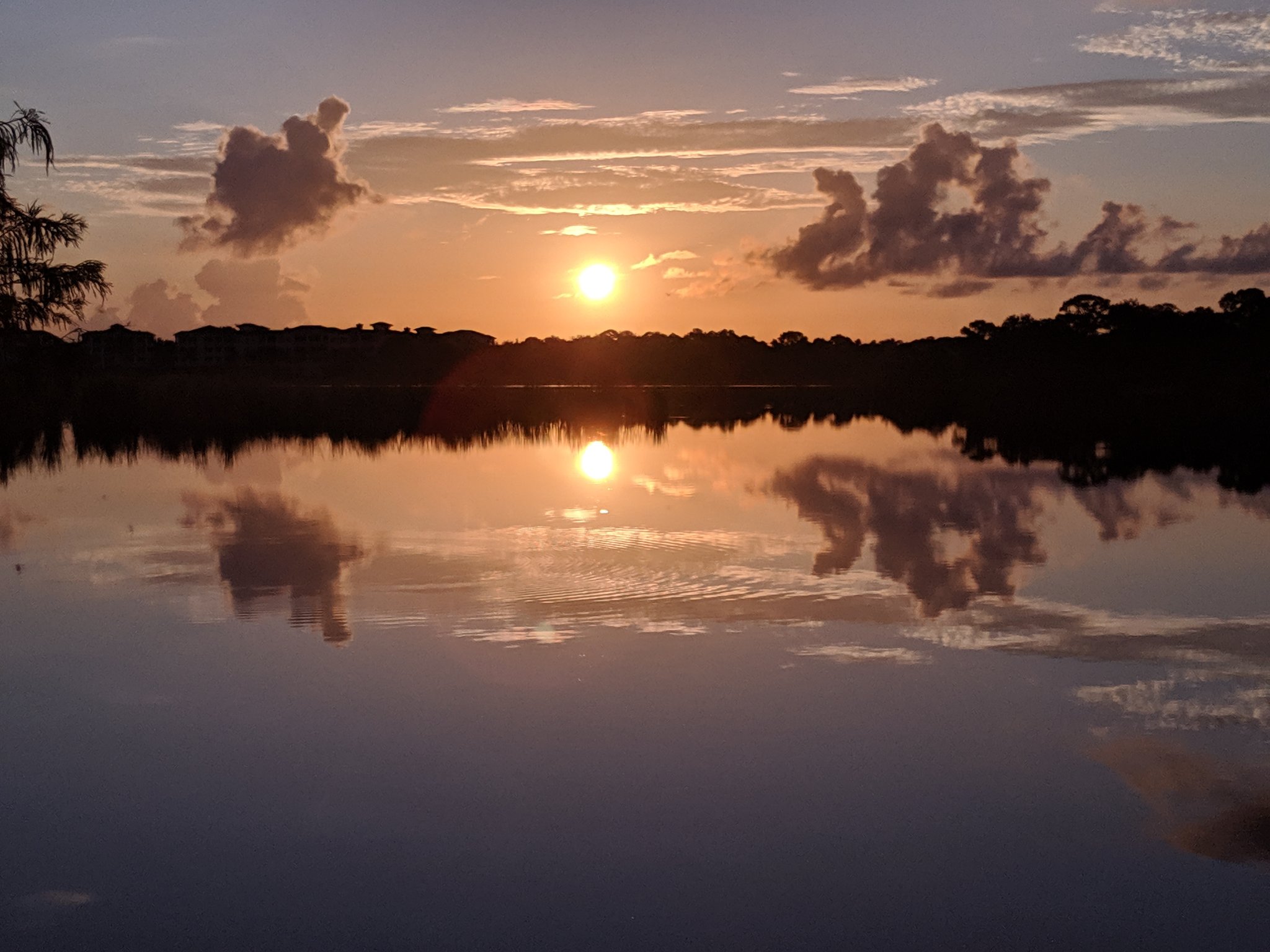
Mainly consisting of open marshlands, deep ponds, shallow pools, and canals, the Celery Fields are edged by oaks, willows, and pines on the eastern and southern boundaries. The Fields are roughly divided into three segments: the North Cells receive water from the Fruitville Road entry canal and have the deepest ponds. From there, the water is channeled into the Central Cells which cover the area that you see when looking west from the hill. The water then flows under Palmer Boulevard into the South Cells, and then southward into Phillippi Creek.
In early 2001, Sarasota Audubon began conducting bird surveys at the Fields. To date, 246 species have been recorded. Wintertime offers particularly good birding, hosting sparrows, Marsh and Sedge Wrens, and several species of rails, including Sora and Virginia. The Fields also host breeding birds, including Black-necked Stilts, King Rail, Least Bittern, Limpkin, Purple Gallinule, Barn Owl and Eastern Meadowlark. Least Terns breed on nearby buildings and use the ponds as a primary food source. Rarities show up from time to time, including Upland and White-rumped Sandpipers, Short-eared Owl and Nelson’s Sparrow. In the winter of 2018/2019, birders found a Least Flycatcher and an Ash-throated Flycatcher, the first for the Fields, these birds are unusual for Florida and particularly unusual in Sarasota County.
Sarasota County, recognizing the importance of the Celery Fields as a food and habitat source to a wide variety of birds and other wildlife, worked with Sarasota Audubon to restore 100+ acres in the Southern Cells into a more traditional wetland. The County also constructed two boardwalks: one on Palmer Blvd and the other on Raymond Rd. Both boardwalks provide excellent opportunities for wildlife watching.
Historically the area was a sawgrass marsh and evidence of early native settlement has been found. The site is also rich in paleontological artifacts. A history of the Celery Fields can be found below.
A History of the Celery Fields
This article was adapted by Arny Rawson from History and Agriculture in Sarasota County Florida, published by the Sarasota County Fair and Sarasota County Historical Commission, 1976.
From about 1920, the Palmer interests (also known as the Sarasota-Venice Company, originally started by Mrs Potter Palmer who died in 1918) extended the vegetable growing area from Gulf Gate to the location of the present Celery Fields. Prior to that time, the site was a rich muckland known as Big Camp Saw Grass and Tatum Saw Grass. The muck (peat) occupied the lowest 2,000 acres, and was surrounded by a higher dark loam area and an even higher sandy area. The depth of the muck varied from a few inches to 8 feet, and was composed of from 66 to 73% organic material. Below the muck layer was sand, which varied inversely with the depth of the muck. A clay or marl layer lay about four feet deeper still.
The Palmer interests engaged Arcadia engineer J .A. Kimmel to make topographical maps and a drainage plan for the entire 8,000-acre area. The site was organized as the Sarasota Fruitville Drainage District in 1921. The firm of Cravens and Kimmel prepared excellent 1-foot contour maps for drainage, which made development in the Phillippi Creek watershed possible.
Construction of the Celery Fields began in 1923. The main canals were finished by 1926. An experimental farm of 2,000 acres was set up under the direction of E.L. Ayres, then County Agent.
Although different vegetables were tried, by 1927, it was decided to grow predominantly celery. Roads were built across the area. Since the muck was constituted in great part by acid, lime was added: 1.5 to 2 tons of ground limestone and 1 to 1.5 tons of hydrated lime per acre. Unit ditches served 10-acre tracts. Artesian wells served two 10-acre tracts from each 6-inch well. At first, just a spring crop was harvested. Later both spring and fall crops were grown.
The farms, which were sold off as private units, continued to produce celery until the property was acquired by the County in 1995.
Further notes from Arny Rawson
Prior to the development of the farm, water levels are not mentioned. It is assumed however, that in the lowest areas, there was standing water throughout most of the year. After drainage, the celery patches were moist to dry for most of the year, but there was no standing water except after heavy summer rains.
There was no record of wildlife before development, but one can assume that it was abundant. During its farm stage, the area was good for birding, probably many more species than now.
Directions to the Celery Fields
From I-75 take Exit 210, Fruitville Road east. Make right at Coburn Road light and follow road as it curves past the Fruitville Library. The Celery Fields will be on your left; Ackerman Lake will be on your right. To get to the parking lot, proceed about .5 mile south from Ackerman Lake and make a left onto Palmer Boulevard. After about .3 mile, make a left into the parking lot, which also has public restrooms.
Benderson Park is a large lake developed for rowing and is 12 minutes from our homes. There is a bike and hiking trail around the lake, which is a little over three miles. The park itself is three miles from our home, so an ambitious hiker could hike over there, around the lake, and back for about a total of 9 miles.
Heron's Nest Nature Park Loop a nine minute drive from us and is a 0.9 mile loop trail located near Sarasota, Florida that offers the chance to see wildlife and is good for all skill levels. The trail is primarily used for walking, trail running, birding, and road biking and is best used from October until April. Dogs are also able to use this trail but must be kept on leash.
Jigg's landing is a nice Manatee Park 15 minutes away from our home. You can rent a kayak or a cabin.
Located on the Ever's Reservoir it offers freshwater fishing and canoeing opportunities on the Evers Reservoir and Braden River. The property was purchased in 1944 by Al (Jiggs) and Agnes Metcalf and included a 7-acre piece of property. Their dream was to create a fish camp on the banks of the Braden River and they did so, creating a landmark that served Manatee County for more than 40 years.
Jiggs Landing Preserve is open daily, sunrise to sunset.
Are you an angler who prefers to be out on the water before sunrise? Preserve hours are limited, but Boat Ramp access is not. Purchase your one-time Gate Access Card so you can be out on the water at the time of your preference. Cards are available for sale at the G.T. Bray Recreation Center for $30/each. A replacement card is $5/each.
THINGS TO DO
Jiggs Landing is well known for its boat ramp which allows visitors to launch directly into the Braden River. The newly renovated site also includes a number of great recreational features, available to the public sunrise to sunset, including:
Picnic areas and pavilions Boardwalks Concession stand Wildlife viewing areas Dock Nature-themed playground Interpretive signage Kayak concessions Food, bait, and drink concessions Boat Ramp (nighttime access card: $30 - see details above)
Kayak/Canoeing: A new handicap accessible canoe/kayak launch is located at the site. The launch gives paddlers access to the entire Braden River and its freshwater system.
Rentals and Concessions: For information on cabin and pavilion rentals, watercraft rentals, guided river tours or bait/concessions, please visit Jiggs Landing Outpost website or call (941) 727-4181.
Pavilion: The large pavilion with picnic tables/benches and grills is available for use by individual/private parties of up to 50 people. Please note extra tables, chairs, and activities that are open to the public require a Special Event Permit. You can reserve the pavilion by calling (941) 727-4181.
Linger Lodge Restaurant and Bar is 12 minutes from our homes. It is a fun little place. It is next to an RV campground where some of your visitors may want to stay. You can rent a kayak or walk along the River. .


 Click for the Google Map Directions